
Quick Summary
Investing in land plots near proposed or under-construction metro lines remains one of the most reliable strategies for securing high capital appreciation. This detailed analysis examines how Transit-Oriented Development (TOD) policies inflate land values, which geographical micro-markets in Delhi NCR hold the greatest potential, and the rigorous legal due diligence required to protect your capital. Learn how to identify premium master-planned projects, compare the performance of transport-aligned plots against standard residential offerings, and design a high-yield investment roadmap.
Understanding Transit-Oriented Development and Land Valuation
What is the relation between metro corridors and land price appreciation?
Urban infrastructure projects are the primary catalysts for real estate expansion. Among these, rapid transit networks like metro corridors exert the most immediate and profound impact on surrounding land prices. When a new metro line is announced, the land value trajectory undergoes a multi-phase shift. The first phase, driven by speculative interest, begins during the planning and feasibility stage. Early investors purchase land based on projected future convenience. As construction advances to the execution phase, speculative pricing transitions into solid, infrastructure-backed valuation increases.
The economic mechanism at play is the reduction of commute times and the expansion of the labor pool reach. Land parcels that were once considered peripheral suddenly become highly accessible to major employment hubs. This increased accessibility shifts the demand curve outward. According to spatial economics, as transport costs fall, the bid-rent gradient for land steepens near transit access points. Consequently, residential and commercial plots located within a one-to-two kilometer radius of a planned metro station historically command premiums ranging from 20 percent to upwards of 50 percent compared to identical parcels situated further away.
This dynamic is further accelerated by public planning frameworks. Municipal authorities frequently implement Transit-Oriented Development policies along rapid transit paths. These policies encourage high-density zoning, mixed-use land allocation, and improved civic infrastructure. By allowing higher Floor Area Ratio (FAR) or Floor Space Index (FSI) near transit lines, local governments make these plots highly attractive to developers. The capital value of the land increases because the prospective revenue generation per square meter of building footprint is substantially higher than in traditional low-density residential zones.
Why do investors prefer plots over built-up apartments near metro lines?
Plotted developments offer several structural advantages over pre-built apartment units, particularly in early-stage infrastructure zones. First and foremost is the rate of physical depreciation. While a concrete apartment structure begins to lose physical value over time, requiring maintenance and eventually redevelopment, land remains a non-depreciating asset class. The entire investment volume in a plot is directed toward the land value itself, maximizing the exposure to the underlying asset appreciation driven by the metro development.
Furthermore, plots offer unmatched flexibility. An investor can hold the land as a pure capital appreciation asset, build a customized structure to suit specific commercial or residential needs, or sell the parcel to developers when the metro line becomes fully operational. The liquidity of plotted land near major transit nodes is also notably higher than that of built-up apartments. Since land is scarce in master-planned urban centers, institutional buyers and private developers are constantly searching for clean-titled land parcels to execute their projects, ensuring a clear exit pathway for early-stage investors.
Identifying Key High-Growth Nodes in Delhi NCR
Which areas in Noida and Greater Noida offer the best plot options?
The National Capital Region (NCR), specifically the Noida and Greater Noida corridors, presents a highly active landscape for plotted investments linked to rapid transit. The expansion of the Aqua Line metro network has changed the investment prospects of sectors along the Noida-Greater Noida Expressway. Sectors such as Sector 142, 143, 150, and the nearby Yamuna Expressway zones have seen marked increases in both inquiry volumes and capital valuations. These regions are structured around wide roads, dedicated green zones, and upcoming corporate hubs, making them ideal for high-density modern living.
In Noida proper, premium land plots are becoming increasingly scarce, prompting buyers to seek alternative structures. While some investors focus purely on undeveloped land, others choose to acquire built-up luxury properties in these same high-growth corridors to hedge their bets. For instance, seeking out luxury independent villas in Noida offers a dual advantage: immediate premium rental yields from corporate executives and long-term capital growth linked directly to the nearby transit extensions. These low-density residential developments combine the autonomy of land ownership with the convenience of premium, ready-to-move infrastructure.
How does the Noida-Greater Noida Metro extension impact surrounding sectors?
The planned extension of the Aqua Line to connect Noida Sector 51 with Knowledge Park V in Greater Noida West is set to unlock significant real estate value. This proposed line will pass through highly populated zones that currently lack high-capacity transit links. The introduction of metro stations will drastically reduce commuter reliance on private transport and shared auto-rickshaws, integrating these suburbs directly into the broader economic core of Delhi and Gurugram.
For land investors, this means the historical discount associated with Greater Noida West is narrowing. As construction work progresses, land values within a two-kilometer corridor on either side of the proposed metro line are experiencing upward adjustments. The sectors positioned near these planned stations are seeing a shift from mid-segment housing dominance to premium commercial and plotted developments. Investors who acquire land in these zones prior to the final track-laying phase stand to capture the maximum margin of appreciation as the project moves toward commissioning.
Navigating the Legalities of Buying Land Near Infrastructure Projects
What legal documents must you verify before purchasing a metro-adjacent plot?
Investing in plots requires a rigorous legal verification process, as land disputes can tie up capital for decades. The first step is to confirm the land ownership title. A buyer must inspect the original title deeds to trace ownership back at least thirty years, ensuring there are no gaps in the chain of transfer. An Encumbrance Certificate (EC) for the past thirty years must also be obtained from the sub-registrar’s office to prove that the property is free from any financial liabilities, mortgages, or legal claims.
Equally critical is verifying the land-use designation in the master plan of the local development authority, such as Noida Authority, Greater Noida Authority, or Yamuna Expressway Industrial Development Authority (YEIDA). Land situated near upcoming public works projects is sometimes earmarked for government acquisition or designated as green belts. Investors must obtain a No Objection Certificate (NOC) from the relevant transit authority to ensure the specific plot does not fall under the direct alignment of the metro line or its ancillary infrastructure. Prior to executing any transaction, it is highly recommended to study the legal terms and service conditions of the local development authorities to understand building bylaws, transfer charges, and construction timelines.
How to avoid disputes when purchasing land near state-sponsored public transport zones?
To avoid ownership disputes, buyers should focus exclusively on RERA-registered plotted developments or directly allotted authority plots. Private land parcels, particularly agricultural land converted for residential use (under Section 143 or equivalent local land revenue acts), carry a higher risk profile. If purchasing from a private developer, verify that the layout plan has been formally sanctioned by the town and country planning department, and that all local body approvals for water, electricity, and sewage connectivity are firmly in place.
Boundary disputes are another common issue with raw land. Buyers must insist on a physical land survey using digital GPS coordinates before signing any sale agreement. The boundaries should match the official revenue maps exactly. Additionally, check for any ongoing litigation involving the land by reviewing records at the local civil courts and revenue tribunals. Engaging an independent legal counsel specializing in local land laws is the safest way to navigate these complexities.
Selection Strategy for High-Yield Plot Investments
What features define a premium plotted development project?
Not all plots located near a metro station will appreciate at the same rate. The layout design and internal infrastructure of the gated community play a decisive role in determining long-term value. Premium plotted developments are characterized by wide internal roads (minimum 9 to 12 meters), underground cabling for electricity and fiber-optic internet, rainwater harvesting facilities, and dedicated security checkpoints. Master-planned communities that offer integrated clubhouses, parks, and retail zones command a substantial premium over simple, unorganized land divisions.
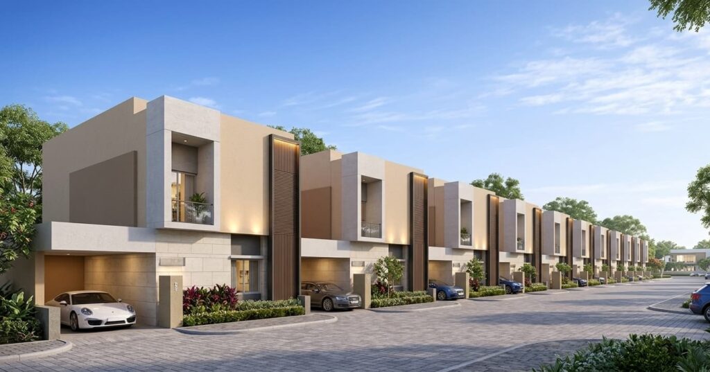
For instance, modern master-planned projects in developing micro-markets showcase how structured planning attracts premium buyers. The Ayodhya Enclave luxury villa project stands as a prime example of an exclusive residential community in Delhi NCR that integrates structured land parcels with high-end lifestyle amenities. Investing in such organized layouts ensures that the physical environment remains clean, secure, and aesthetically pleasing, which in turn attracts high-net-worth individuals and premium rental tenants once the regional transport links are fully functional.
How does the upcoming Jewar Airport connect with the metro network to boost land value?
The development of the Noida International Airport at Jewar is a massive economic driver for the entire Yamuna Expressway region. However, the real value of this mega-project is unlocked by its integration with the regional transport web. Plans are already underway to connect the Jewar Airport with the existing Aqua Line metro network and a high-speed metro corridor linking directly to the Indira Gandhi International Airport in Delhi.
This multi-modal connectivity transforms the surrounding sectors into global business corridors. Land plots located near these upcoming airport-metro transit hubs are positioned for exponential growth. Logistics companies, corporate offices, hospitality brands, and residential developers are actively acquiring land in these sectors. For individual investors, purchasing a plot in these corridors during the early infrastructural stages represents a rare opportunity to ride a sustained multi-decade wave of capital appreciation.
Metro Proximity vs. Standard Residential Plot Performance
To clearly understand why transport proximity is worth a financial premium, it is useful to compare the performance metrics of metro-adjacent plots against standard residential plots located in mature but disconnected suburban areas. The following table highlights the key differences in investment performance over a typical five-to-seven year investment cycle.
| Investment Metric | Metro-Proximate Plots (Within 1.5 km) | Standard Suburb Plots (No Transit Access) |
|---|---|---|
| Annual Appreciation Rate | 15% – 22% (Accelerates near project completion) | 6% – 9% (Steady, inflation-aligned growth) |
| Exit Liquidity | High; attractive to developers and private builders | Moderate to Low; limited to end-user buyers |
| Permitted Floor Area Ratio (FAR) | Higher under Transit-Oriented Development norms | Standard restrictive zoning policies apply |
| Rental Yield Potential | High; easily lets out to transit-dependent workforce | Low; dependent on local commercial development |
Long-Term Outlook for Plotted Developments in Urban Corridors
How does infrastructural integration shape future urban housing patterns?
As metropolitan regions swell, the traditional model of monocentric cities is giving way to polycentric urban systems. These systems rely heavily on high-speed transit networks to connect distinct business and residential hubs. Consequently, land values are no longer determined solely by geographic distance from the historical city center, but by temporal distance, measured in the minutes required to reach key employment nodes via rapid transit. This structural shift is redefining the outer boundaries of the real estate market.
To make informed decisions in this rapidly changing market, staying updated with the latest property market updates is highly beneficial for both retail and institutional investors. Market dynamics, regulatory adjustments, and new transit routes can change overnight, directly impacting land values. Real estate research indicates that planned infrastructure integration creates a decentralized housing demand, where buyers actively seek well-connected suburban plots that offer larger living spaces, cleaner environments, and lower density, without sacrificing proximity to urban conveniences.
What is the optimal holding period for capital growth in newly connected corridors?
For land investments aligned with upcoming metro connectivity, timing is the key to maximizing returns. The optimal holding period typically spans five to seven years. This window allows the project to transition from a speculative proposal, through the construction phase, and into full commercial operations. Capital appreciation usually peaks in two distinct waves: first, when the civil construction begins to show physical progress, and second, when the safety approvals are secured and the line is opened to the public.
Exit strategies should be executed shortly after the metro line becomes operational. At this stage, institutional developers enter the market to acquire consolidated land parcels for high-rise commercial complexes or residential townships, providing retail plot owners with maximum leverage. Holding the asset beyond this point still yields solid returns, but the rate of appreciation tends to align with standard market growth once the initial infrastructure premium has been fully absorbed into the asset pricing.
In conclusion, investing in plots near upcoming metro corridors represents a highly strategic allocation of capital, combining the stability of land ownership with the explosive growth potential of major infrastructure projects. By understanding the principles of Transit-Oriented Development, targeting the right geographic nodes in NCR, conducting meticulous legal due diligence, and choosing well-structured plotted developments, investors can secure substantial, long-term capital appreciation while minimizing downside risks. Working with reputable real estate advisors like Heritage Prime ensures you access clear-titled, highly strategic land parcels that stand to benefit most from the ongoing infrastructure boom.
Frequently Asked Questions (FAQs)
1. How much premium do plots near upcoming metro stations command?
Plots within a 1.5-kilometer radius of an upcoming metro station generally command a 20 percent to 50 percent premium compared to similar plots located further away. This premium is driven by high demand from home buyers and developers who value transit accessibility and the higher development rights granted under Transit-Oriented Development policies.
2. Is it safe to buy agricultural land near proposed metro corridors?
Buying agricultural land carries high risk unless it has undergone formal land-use conversion (CLU) to residential or commercial use under local state laws. Unconverted agricultural land near major infrastructure may also be subject to government acquisition for public utility works, making RERA-approved residential layouts a much safer choice.
3. How does Transit-Oriented Development (TOD) policy affect plot FSI/FAR?
TOD policies generally increase the permitted Floor Area Ratio (FAR) or Floor Space Index (FSI) for properties located within the designated transit zone (typically up to 1 or 1.5 km from the station). This allows landowners and developers to build more floor space on the same plot, significantly increasing the financial value and utility of the land.
4. What is the impact of multi-modal transport hubs on regional land values?
Multi-modal transport hubs, which combine metro lines, bus rapid transit systems, regional rail, and airports, have the most powerful impact on land appreciation. They draw massive commercial interest, corporate relocations, and high-density residential projects, driving long-term, compounding growth in surrounding land values.