
Quick Summary
Physical proximity is no longer the primary driver of real estate valuation: accessibility is. This analytical piece breaks down how high-speed transit networks, strategic expressways, and airport hubs are converting previously overlooked suburban tracts into highly coveted residential and commercial plot corridors. We examine capital appreciation patterns, risk factors, and strategic methodologies to help modern land buyers make data-backed investment decisions in emerging growth corridors.
The Connectivity Paradigm: Why Infrastructure Shapes Land Values
The landscape of real estate acquisition has undergone a fundamental transformation. Historically, land valuation was governed by strict proximity to centralized urban business districts. This monocentric city model concentrated premium pricing within a narrow radius of the urban core. However, modern infrastructure expansion has dismantled this traditional framework, replacing it with a polycentric urban model where connectivity, rather than geographical distance, dictates desirability and market pricing.
As metropolitan centers become congested, home buyers and long-term investors are shifting their focus to outer suburban boundaries. The primary catalyst facilitating this transition is the rapid implementation of high-capacity transport corridors. When a previously isolated rural or semi-urban area gains access to a multi-lane expressway, a regional rapid transit network, or a massive airport hub, transit times to central economic zones decrease dramatically. This compression of travel time alters the mathematical formulas used by real estate analysts to calculate land value, driving up acquisition rates for plots located near exit ramps and transit interchanges.
Furthermore, land represents a unique asset class characterized by finite supply and infinite customizability. Unlike high-density apartments, where ownership is limited to a fractional share of undivided land space, plotted developments offer complete sovereignty over the physical parcel. When these flexible assets are integrated into highly accessible transport nodes, their long-term value appreciation potential increases. Investors recognize that while apartment units undergo structural depreciation, the underlying land appreciates, particularly when surrounded by expanding transport networks.
Highway Projects and Expressways as Real Estate Catalysts
How do expressways impact suburban land valuation?
Multi-lane arterial expressways act as direct economic corridors, bringing development, commerce, and population migration to peripheral regions. When government agencies announce a new expressway alignment, speculative capital flows into adjacent agricultural or unorganized land parcels almost immediately. This occurs because the highway dramatically lowers the barriers of entry for logistical networks, manufacturing hubs, and residential enclaves.
As physical construction progresses, raw land undergoes formal zoning conversions. Agricultural spaces transform into residential, commercial, and industrial plots. The visual progress of asphalt laying and structural flyover completion serves as a physical indicator of progress for retail investors, converting speculative land into tangible, highly liquid real estate assets. This development phase is well-documented in our latest property market updates, illustrating how early-stage investments near transit routes yield substantial capital appreciation over five to seven years.
What is the corridor effect in real estate development?
The corridor effect refers to the concentrated commercial and residential development that occurs along a narrow strip on either side of major transit infrastructure. Instead of growing uniformly outward in a circular pattern, cities now expand linearly along transit highways. These corridors become self-sustaining economic micro-markets, complete with localized employment hubs, retail facilities, educational institutions, and healthcare complexes.
For plot buyers, this linear expansion pattern presents clear geographical advantages. Plots situated within a three to seven-kilometer radius of expressway entry and exit ramps experience the highest demand. These locations provide the ideal balance: they are close enough to access the high-speed transit route in minutes, yet sufficiently set back to avoid the negative externalities of highway living, such as constant sound pollution, particulate emissions, and heavy freight traffic.
Transit-Oriented Development (TOD) and Metro Network Expansions
Why are smart cities focusing heavily on transit-oriented development?
Transit-Oriented Development, or TOD, is a planning strategy designed to maximize the amount of residential, business, and leisure space within walking distance of public transport hubs. By concentrating high-density, mixed-use zoning around metro and railway stations, municipal authorities reduce automobile dependency, lower carbon footprints, and create highly efficient urban centers. Land situated within these designated TOD zones benefits from preferential zoning regulations, including higher Floor Area Ratios (FAR) and simplified commercial usage conversions.
For plot buyers, investing in parcels located inside or directly adjacent to TOD zones ensures long-term asset security and utility. These plots are highly versatile: they can be utilized to construct multi-story residential units, boutique commercial offices, or customized retail structures. The high volume of daily commuters passing through nearby stations guarantees a steady stream of foot traffic, making these plots exceptionally attractive to commercial developers and premium tenants.
Do buyers prefer independent plots near upcoming metro corridors?
Yes, there is a distinct and growing preference among affluent buyers for independent plots located in close proximity to upcoming metro networks. This preference is driven by the desire for private, custom-designed living spaces that do not compromise on city-wide accessibility. Metro systems democratize travel times, enabling suburban residents to commute to distant corporate offices quickly and predictably, bypassing road congestion.
This demand is particularly noticeable in regions where developers construct structured townships offering luxury independent villas in Noida and adjacent micro-markets. Buyers in these locations seek the autonomy of owning land combined with the premium lifestyle amenities of gated communities, such as clubhouse access, professional security, and manicured landscaping, all anchored by a rapid transit station located just minutes away.
The Influence of Modern Airports on Regional Plot Demand
How does a new international airport alter local real estate dynamics?
The construction of a new international airport is perhaps the most powerful singular driver of regional land transformation. An airport is not merely a transport terminal: it is a massive economic engine that attracts multi-billion-dollar investments. To support air operations, governments must rapidly build supporting infrastructure, including high-speed link roads, dedicated metro links, multi-modal cargo terminals, and hospitality corridors.
This influx of infrastructure instantly elevates the profile of surrounding land parcels. Global corporations, logistics companies, luxury hotel chains, and retail developers compete for land nearby to establish their physical presence. This commercial competition creates a wealth effect that ripples outward into the residential sector, driving up the demand and pricing for residential plots as employees and business operators seek housing close to their workplaces.
What long-term capital appreciation can investors expect from airport-adjacent plots?
Historical real estate trends show that plots located within a 15 to 30-kilometer radius of major international airport projects experience rapid, multi-phase capital appreciation. The initial wave of appreciation occurs during the planning and land acquisition phases. The second wave takes place as physical construction begins and road connections are established. The final, most sustainable wave of value increase occurs once the airport becomes operational and commercial flights commence.
During these phases, early land buyers often see their initial investments double or triple in value. The key to capturing this growth lies in identifying planned master communities that offer security, structured layouts, and clear titles. These properties stand out as prime examples of how well-planned, airport-linked developments become premium residential zones, attracting high-net-worth buyers looking for luxury lifestyles outside of congested downtown cores.
Comparative Analysis of Connectivity Drivers
To understand the nuances of land investment, it is helpful to analyze how different forms of connectivity impact plot values. Each transit system caters to a different target demographic and exhibits unique development cycles. The table below outlines the critical differences in investment characteristics across the four major infrastructure categories.
| Infrastructure Type | Primary Impact Zone | Appreciation Horizon | Target Buyer Segment | Primary Value Driver |
|---|---|---|---|---|
| Expressways | 3 to 7 km from exits | Medium-Term (3-5 Years) | Logistics, Industrial & Residential developers | Reduced inter-city travel times and ease of transit |
| Metro/Rapid Rail | 500m to 2 km from stations | Short-Term (1-3 Years) | Daily commuters & High-density developers | Pedestrian convenience and daily commuter accessibility |
| Airports | 15 to 30 km radius | Long-Term (5-10 Years) | MNCs, Luxury residential & Commercial buyers | Global connectivity, employment, and hospitality hubs |
| Arterial Link Roads | Direct frontage plots | Short-Term (1-2 Years) | Local retail, clinics & Medium density builders | Immediate physical access and high commercial exposure |
Navigating the Risk Landscape of Strategic Plot Purchases
What are the primary legal risks when buying peripheral plots?
While the promise of infrastructure-driven appreciation is compelling, peripheral land markets carry distinct risks. The most prevalent challenge is verifying the absolute clarity of the land title. Peripheral zones often consist of ancestral holdings, agricultural cooperatives, or parcels with complex ownership histories. Before committing capital, buyers must perform deep due diligence, ensuring the seller has the legal right to transfer ownership and that the land is free from active litigations or mortgage liabilities.
In addition, understanding zoning compliance is essential. Land located near highways or railway tracks may be subject to strict development buffer zones where building construction is legally prohibited. Buyers must align their purchase decisions with formal master plans published by local development authorities. Reviewing our comprehensive legal terms and service conditions provides valuable guidance on how structured real estate transactions must be conducted to protect buyer interests from zoning violations and contractual issues.
How can buyers verify infrastructure development timelines?
Speculative land buying based on unapproved infrastructure announcements is a risky strategy. Projects can be delayed for years due to land acquisition issues, environmental challenges, or changing political priorities. To mitigate this risk, buyers should focus on areas where construction contracts have already been awarded, land clearing is physically visible, and budget allocations are secured.
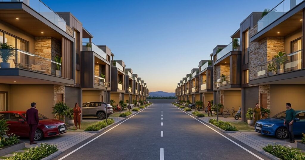
Rather than buying unorganized individual land parcels, investing in planned, developer-backed township layouts offers a safer route to capital appreciation. For example, the Ayodhya Enclave luxury villa project stands out as a highly reliable option. Located in a strategically planned growth zone, it provides buyers with clear legal titles, planned internal roads, physical security, and immediate access to regional transit routes, minimizing the risks associated with raw land purchases.
Ultimately, connectivity is the key factor driving modern land markets. By focusing on planned transit-oriented corridors, verifying regulatory approvals, and selecting high-quality projects, investors can build resilient, high-yield land portfolios. Partnering with reputable, established real estate consulting companies like Heritage Prime ensures that you acquire properties with clear titles, strategic location advantages, and high long-term appreciation potential.
FAQs on Connectivity and Plot Demand
1. Why does expressway proximity cause such rapid increases in plot prices?
Expressways dramatically reduce travel times, connecting peripheral regions to central business districts. This transformation makes suburban land practical for daily commuting, encouraging commercial investments, industrial setups, and high-quality residential enclaves. This sudden surge in utility drives up land values rapidly.
2. Is it safer to buy plots in a planned township or stand-alone land?
Planned townships are generally much safer because they offer approved layouts, clear legal titles, existing infrastructure like water and electricity, and built-in security features. Stand-alone land often carries higher legal risks, zoning hurdles, and utility installation challenges.
3. What is the recommended distance to maintain between a plot and a major transit corridor?
The ideal distance is between 1 and 5 kilometers from major expressway interchanges or metro stations. This range provides easy access to transit routes in under ten minutes while protecting your property from highway noise, heavy traffic, and air pollution.
4. How do I verify if a suburban plot has a clear, legally sound title?
To ensure a clear title, verify the plot details through state land registry portals, check for past ownership disputes, obtain an encumbrance certificate for the last 30 years, and ensure the land has RERA registration if it is part of a commercial development.